GRLevelX Tools
RedTeamWx depends on donations in order to pay domain/hosting costs. Dorking out on convection? Winter Weather? Hopping from radar to radar attempting to dork out? Join the distinguished list of contributors by clicking on the donate button ------->
Reminder: There is no guarantee that RTWX placefiles will always be available or that the data displayed therein will always be up-to-date and/or correct. Additionally, these placefiles are in continual development and are subject to change at any time without prior notice.
REFERENCE
GR2Analyst 1.xx Setup Presentation
(outdated but potentially useful for novice users)
DYNAMIC PLACEFILES
The following METAR placefiles were developed from the ground up with operational meteorology and storm chasing in mind. These placefiles are unique for many reasons, such as plotting weather conditions, wind speed/direction and peak wind gusts using custom designed icons and an experience-based METAR decoding logic that highlights significant weather in a highly intuitive and user-friendly manner. Click here for a legend. Note: Looping placefiles require GRLevel2A or GRLevel3 v2.60 Beta3 or higher.
To use the following placefiles, simply copy the link and then paste it into the placefile manager in GRLevelX.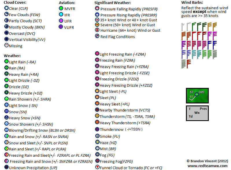
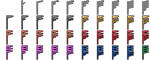
Color Curves and Icons
Custom Color Curves and Icons for Gibson Ridge and PYKL3 Software
GREarth || Reflectivity
PYKL3 || Reflectivity
GR3/GR2A v2.xx || Enhanced SRV (.pal)
PYKL3 || Enhanced Velocity
PYKL3 || Enhanced Echo Tops
PYKL3 || 1-HR/3-HR Precip Color Curve
PYKL3 || Storm Total Precipitation
GR3/GR2A v2.xx || Differential Reflectivity (ZDR)
GR3/GR2A v2.xx || Specific Differential Phase (KDP)
PYKL3 || Correlation Coefficient (CC)
PYKL3 || Differential Reflectivity (ZDR)
PYKL3 || Specific Differential Phase (KDP)
Custom NMD Icons
Custom TVS Icons
GREarth Color Curve/Tables
Satellite WV (RAMSDIS)
Satellite WV (ALTERNATE)
Satellite IR (1)
Satellite IR (2)
Satellite VIS (REVERSE)
500 mb Vorticity
2-Meter Temperature (Mesoanalysis Fill)
2-Meter Temperature (Contour Table for Model Overlay)
2-Meter Dewpoint (Mesoanalysis Fill)
850 mb Temperature (Mesoanalysis Fill)
850 mb Temperature (Contour Table for Model Overlay)
850 mb Dewpoint (Mesoanalysis Fill)
700 mb Temperature (Mesoanalysis Fill)
SBCAPE (Mesoanalysis Fill)
MLCAPE (Mesoanalysis Fill)
MLCAPE HSLC (Mesoanalysis Fill)
MUCAPE (Mesoanalysis Fill)
SBCIN (Mesoanalysis Fill)
MLCIN (Mesoanalysis Fill)
MUCIN (Mesoanalysis Fill)
0-1km SRH (Mesoanalysis Fill)
ESRH (Mesoanalysis Fill)
EBWD (Mesoanalysis Fill)
SCP (Mesoanalysis Fill)
STP (Mesoanalysis Fill)
(save as-is to "GRLevelX\GREarth\mesoanalysis")
850 mb Wind Barb Icon Set
(save as-is to "GRLevelX\GREarth\mesoanalysis")
700 mb Wind Barb Icon Set
(save as-is to "GRLevelX\GREarth\mesoanalysis")
500 mb Wind Barb Icon Set
(save as-is to "GRLevelX\GREarth\mesoanalysis")
300 mb Wind Barb Icon Set
(save as-is to "GRLevelX\GREarth\mesoanalysis")
Backgrounds
(3) In GRLevelX v1.XX: GIS->Settings->Background...
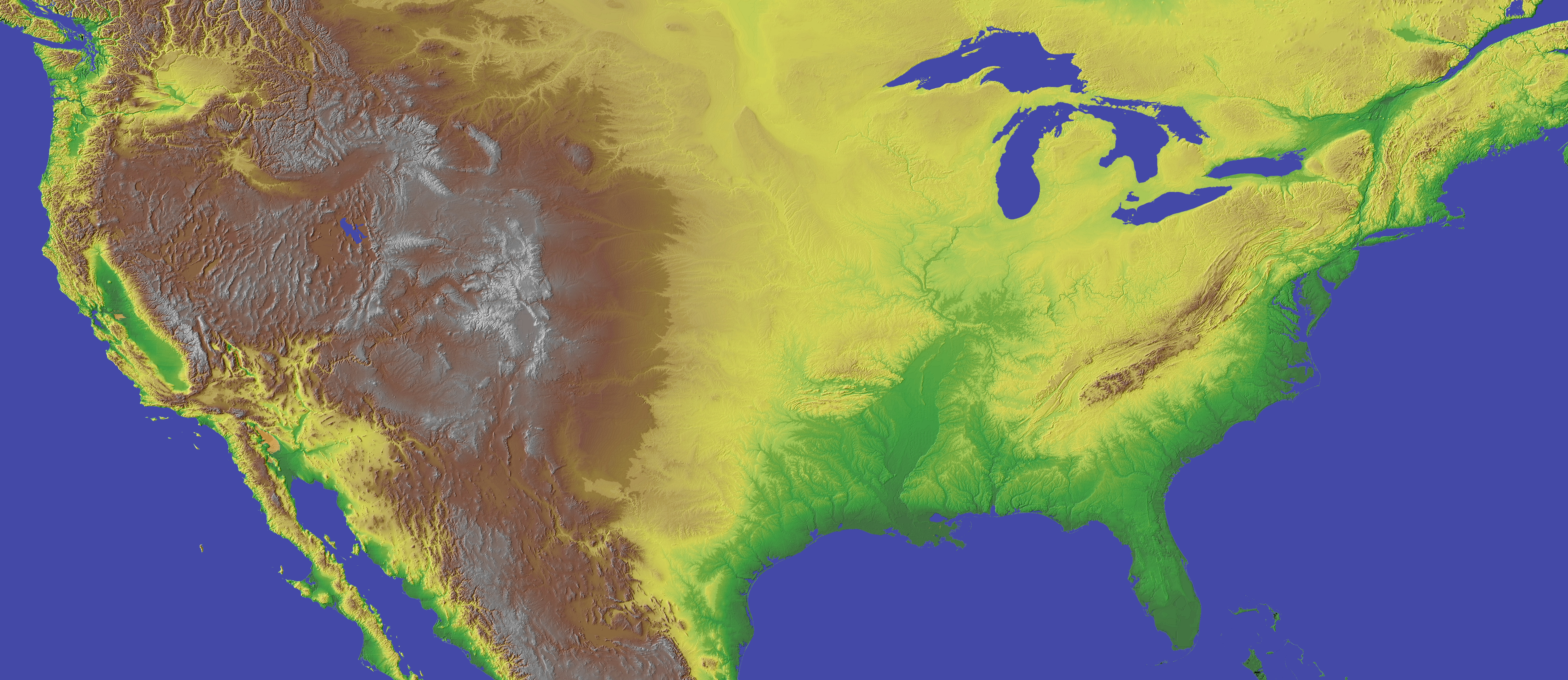
(4) Select Downloaded Map (5) Enter Coordinates
Longitude: From -126 To -66
Latitude: From 24 To 50
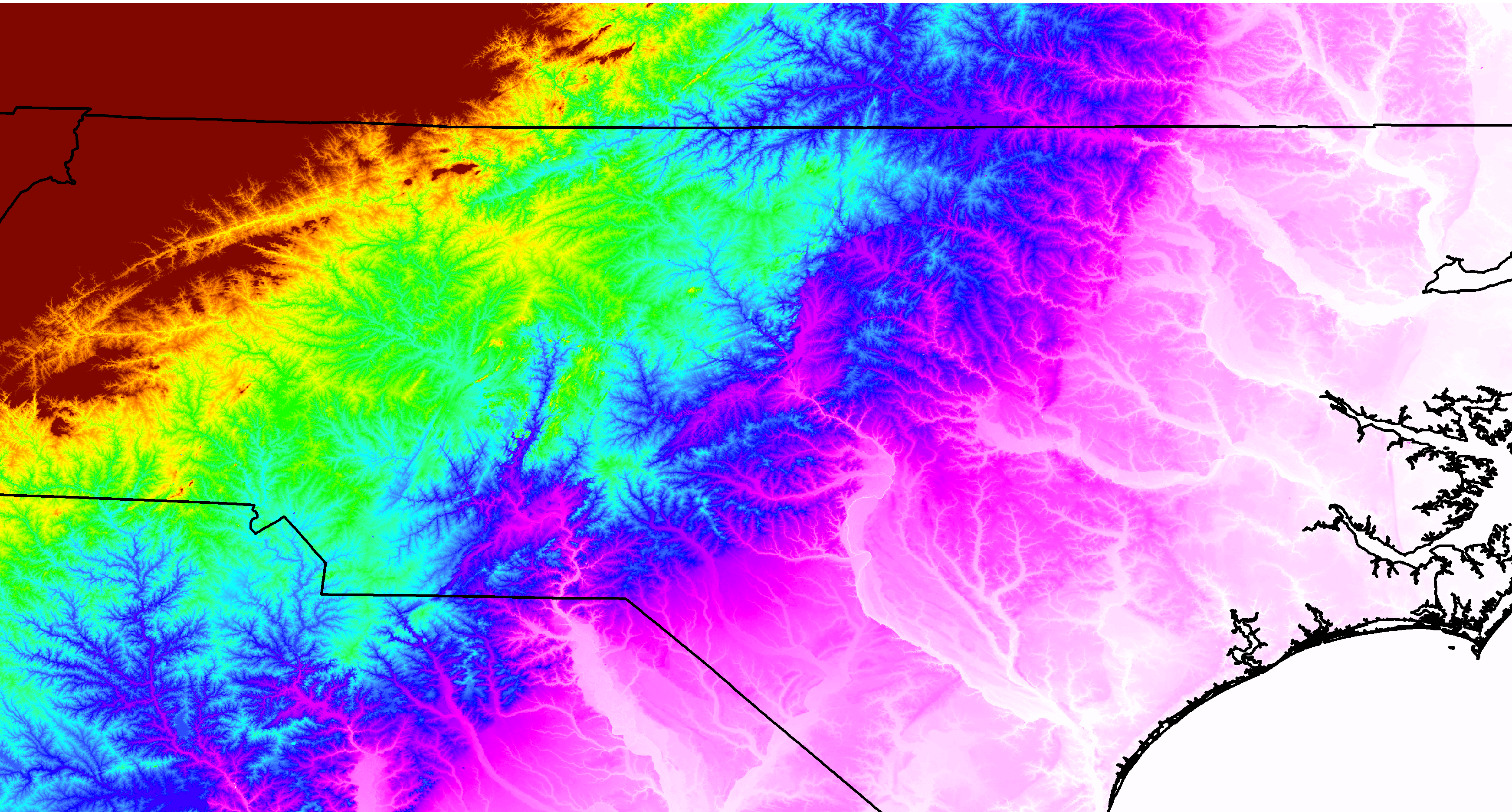
Longitude: From -81.981 To -76.407
Latitude: From 34.017 To 37.012
Shapefiles
To load in GRLevelX, click on GIS->LOAD SHAPEFILE and then select the conus_rivers_lakes .shp and .sty files from the appropriate directory (where you unzipped conus_rivers_lakes.zip.
Tip: Load the AHPS river gauge placefile with the CONUS rivers and lakes shapefile for a better understanding of the hydrology in your area.
Disclaimer: Always keep alternative routes in mind, especially when travelling on dirt roads. Red Team found this out the hard way when a dirt-road escape route turned into a dead-end, leaving us uncomfortably exposed as a nasty supercell bared down on our position, a flat, featureless, barren location in central TX.
"But.. it was on the map? Tough !@#$, think fast!"
These took a lot of work, i.e. downloading road shapefiles for every county of every state and compiling them into discrete state-based files. If you prefer to avoid the tedious nightmare of county-based shapefiles, download the zip file for the state(s) listed below, then unzip the contents into a folder (preferably your GRLevelX folder) and then add the .SHP file and .STY file via the GIS/Load Shapefile menu in GRLevelX.
Canadian Provinces/TerritoriesAlaska
Alabama
Arkansas
Arizona
California
Colorado
Connecticut
Delaware
Florida
Georgia
Hawaii
Idaho
Illinois
Indiana
Iowa
Kansas
Kentucky
Louisiana
Maine
Maryland
Massachusetts
Michigan
Minnesota
Mississippi
Missouri
Montana
Nebraska
New Hampshire
New Jersey
New Mexico
New York
Nevada
North Carolina
North Dakota
Ohio
Oklahoma
Oregon
Pennsylvania
Rhode Island
South Carolina
South Dakota
Tennessee
Texas
Utah
Vermont
Virginia
Washington
Wisconsin
West Virginia
Wyoming